Bevölkerung: 1,815
Besonderheiten:
Little Britches Rodeo, May
Wagon of the Barnard Express and Stage Line with its glossy red paint
Mt. Begbie Lookout, 16 kilometers south of 100 Mile House
Mt. Timothy Ski Area
Geschichte:
Along the Gold Rush Trail between Kamloops and Quesnel (as it is known today) a roadhouse had been built in 1862. The house (Bridge Creek House, named after the nearby creek) would later become known as 100 Mile House marking the miles from the origin of the trail at Lillooet. By 1930, the town consisted of a roadhouse, a general store, a post office, a telegraph office, and a power plant. Population 12.
Today, the population is not very large however this town is responsible as a staple service and commercial area of the surrounding communities and industries within the Cariboo - a combined population of 200,000!
Klima:
Summer average 20 degrees Celsius (very dry, and evenings cool)
Winter average -15 degrees Celsius (starts late November until late February approximately)
100 Mile House Unterkünfte
100 Mile House Things to Do
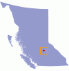
British Columbia